Wildlife & Nature
Palo Verde: The Boat Tour Is Not the National Park
Guanacaste Experiences editorial team
·
6 October 2026
·
7 min read
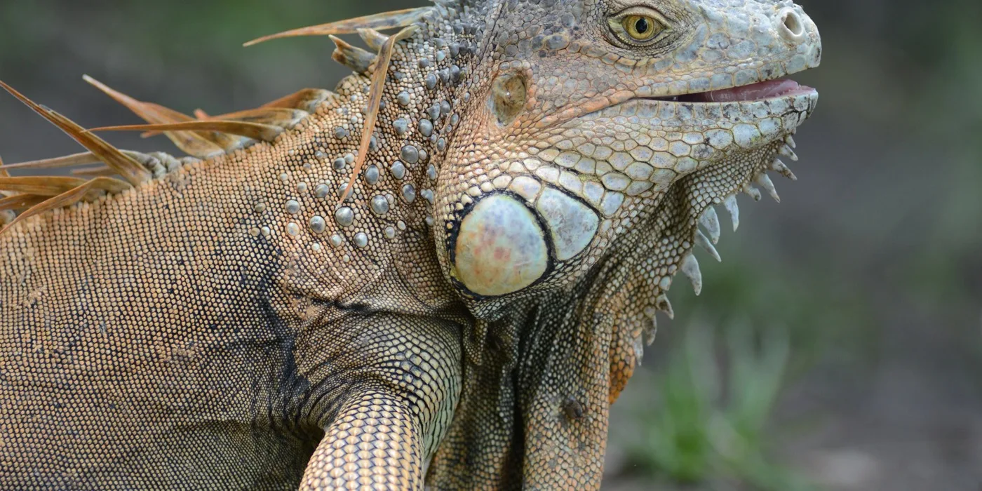
Hero photo: Mariordo (Mario Roberto Duran Ortiz) / Wikimedia Commons (CC BY-SA 3.0)
In this guide
What the boat trip actually isWhat the park itself isWhat the May 2026 fire changedSo which should you do?Getting there, and the roadWhen to goTwo quite different days are sold under the name "Palo Verde", and most people book one while picturing the other.
The common one is a boat trip on the Tempisque, the river that forms the park’s eastern boundary. The rarer one is the national park itself, reached down thirty kilometres of gravel. Both are worth doing. They are not the same day, they do not cost the same, and since May 2026 the difference between them matters more than it used to.
What the boat trip actually is
The boat tours run on the Tempisque, which borders the national park rather than running through it. Operators launch from the Cipancí reserve, meeting at an office in Ortega. You spend roughly two hours on the water looking at the bank.
What that delivers is genuinely good: crocodiles hauled out on the mud, howler monkeys in the gallery forest, iguanas and garrobos in the branches, and — in the right months — the wading birds that crowd the river margins. It is the most reliable wildlife-per-hour trip in this part of Guanacaste, and it requires nothing of you but sitting down.
What it is not is a visit to the wetland. Nobody is lying to you; the river is the park’s boundary and the wildlife is real. But if you came for the famous flooded marsh with thousands of birds standing in it, that is inside the park, down a different road.
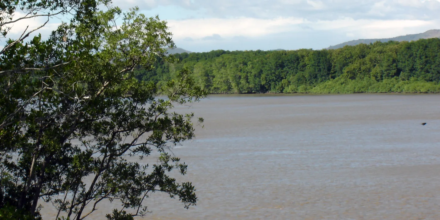
The river is brown
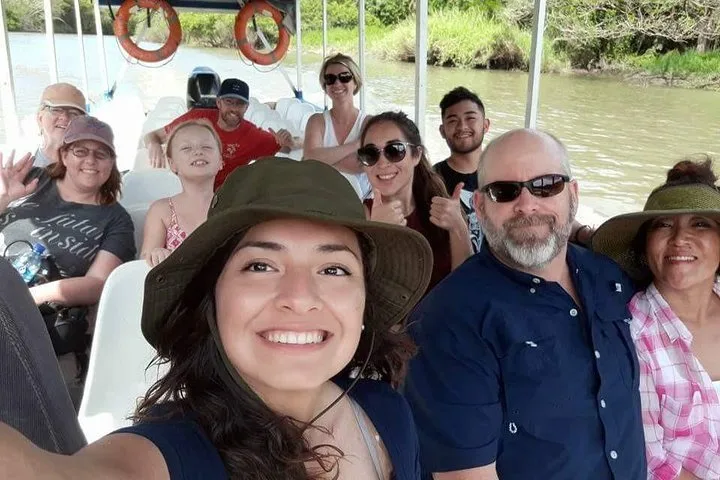
The Tempisque is a tidal, sediment-heavy river, which is exactly why it supports what it supports. The photograph at the top of this page is an honest one. Listings that show turquoise water are showing you somewhere else.
What the park itself is
Palo Verde National Park covers 19,800 hectares between the Bebedero and Tempisque rivers, in the canton of Bagaces. It is a Ramsar site — a wetland of international importance — and more than 280 bird species have been recorded there, along with crocodiles, iguanas and garrobos.
The draw has always been seasonal concentration. In the dry season, as the surrounding country hardens, water and wildlife contract into the same shrinking places. The Organization for Tropical Studies, which runs a research station in the park, puts the window at December to April, when animals gather at the remaining water holes and the wading birds bunch up.
The park is open daily, 8am to 4pm. Non-resident entry is $13.56 for adults and $5.65 for children, and payment is by card only — there is nowhere to pay cash, which catches people out.
What the May 2026 fire changed
On 28 May 2026 a lightning strike inside the wetland started a fire that burned 3,617 hectares of wetland and a further 7 hectares of forest. That is the great majority of the marsh that made the park famous, inside a Ramsar site.
The recovery estimates are worth reading carefully, because two very different numbers are circulating and both are correct:
Recovery estimates reported in July 2026. The two figures describe different things and are often conflated in headlines.
| What burned | Extent | Estimated recovery |
|---|---|---|
Wetland vegetation | 3,617 hectares | About 5 years |
Forest | 7 hectares | 50 to 60 years |
Recovery of the wetland depends first on rain. Reporting in late July said the lack of it was complicating things, and that without rainfall the alternative is irrigation infrastructure the park does not have. The same reporting described blackened ground, charred trees and kilometres of vegetation reduced to ash.
We have not been in to see it since, and we are not going to tell you what it looks like today on the strength of July’s reporting. What we can say is that the park remains open on normal hours and fees, which SINAC still published in September 2026, and that anyone planning a dry-season birding trip around the flooded marsh should contact the park or the OTS station before committing to the drive.
So which should you do?
For most visitors on a week’s holiday, the boat trip. It is shorter, it needs no 4x4, it reliably produces crocodiles and monkeys, and — this is the part the fire makes relevant — it happens on the river, not in the burned wetland, so what it delivers is the least changed by this year’s events.
Go into the park itself if you are a serious birder, if you want the research-station side of Costa Rica rather than the tour-boat side, or if you simply prefer walking to sitting. Go in the dry season, go early, and treat the drive as part of the day rather than an inconvenience before it.
If you would rather not drive at all, the Palo Verde boat safari with coffee and culture is a full day with transport, a two-hour safari, lunch and a Chorotega pottery stop. The straightforward version is the boat tour from Ortega, which is cheaper and assumes you arrive under your own steam.
Getting there, and the road
From central Liberia, Bagaces is 29 minutes, Ortega is 70 minutes and the park’s ranger station is 77 minutes. From Tamarindo the boat tours are about 1¼ to 1½ hours. Ortega is 54 minutes from Liberia airport — one of the few trips in Guanacaste the airport is closer to than the city, which is useful on an arrival or departure day.
The park approach is Route 1 to Bagaces, then 30 km south on gravel. SINAC recommends a 4x4 in the rainy season — note that it says *preferable*, not required. In the dry season an ordinary car driven sensibly is generally fine.
Do not follow the satnav here
The main boat operator tells customers to use its own written directions because Google Maps and Waze show roads around Ortega that do not exist. That warning is on its own website, and it is not the kind of thing a business says lightly. Get directions from whoever you book with and follow those.
When to go
December to April is the established answer, and the logic is sound: as the dry season bites, water and animals concentrate, so you see more in less space. That is the window the research station names.
The trade-off is that this is also when Guanacaste is busiest and hottest, and when the landscape around the park is at its most parched. The green season gives you a greener park, more water spread over more ground, and therefore wildlife that is harder to find — plus a gravel road that SINAC would rather you took in a 4x4. For a wider view of the seasons, see our month-by-month guide.
See the Palo Verde boat tour
The river trip, which is the version least affected by the 2026 fire.
Does the Palo Verde boat tour go inside the national park?
No. The boat tours run on the Tempisque river, which forms the park’s boundary, launching from the Cipancí reserve near Ortega. The wildlife is real and the trip is good, but it is a river trip alongside the park rather than a visit to the wetland inside it. The park itself is reached separately, down 30 km of gravel from Bagaces.
What happened at Palo Verde in 2026?
A lightning strike inside the wetland on 28 May 2026 started a fire that burned 3,617 hectares of wetland and 7 hectares of forest in what is a Ramsar site of international importance. Reporting in July put recovery of the wetland vegetation at about five years and regeneration of the burned forest at 50 to 60 years, with rainfall the limiting factor.
Is Palo Verde National Park still open?
Yes. SINAC still listed the park as open daily from 8am to 4pm as of September 2026, at $13.56 for non-resident adults and $5.65 for children, card payment only. If your trip depends specifically on the flooded wetland and its birds, contact the park or the OTS research station before driving out.
When is the best time to visit Palo Verde?
December to April. In the dry season water and wildlife contract into the remaining water holes, which is what produces the concentrations of wading birds the park is known for. The green season is greener but the wildlife is spread out and harder to find, and the gravel approach road is in worse shape.
Do you need a 4x4 to get to Palo Verde?
Not necessarily. The approach is Route 1 to Bagaces then 30 km of gravel, and SINAC recommends a 4x4 in the rainy season — the wording is "preferable", not required. In the dry season an ordinary car driven carefully is generally fine. Check your rental agreement, which may be stricter than the road.
How far is Palo Verde from Liberia?
The ranger station is about 77 minutes from central Liberia and Bagaces about 29 minutes. Ortega, where the boat tours meet, is about 70 minutes from Liberia city but only 54 minutes from Liberia airport — one of the few Guanacaste trips that is closer to the airport than the town.
Sources
Facts in this guide were checked against these references on the dates shown.
SINAC — Parque Nacional Palo Verde — Palo Verde lies between the Bebedero and Tempisque rivers in the canton of Bagaces and covers 19,800 hectares; a Ramsar wetland with more than 280 bird species recorded, plus crocodiles, iguanas and garrobos. Open every day 8am–4pm; non-resident entry $13.56 adult and $5.65 child; payment accepted by card only. Access is on Route 1 to Bagaces and then 30 km south on a gravel road, for which SINAC recommends — but does not require — a 4x4 in the rainy season. (accessed 20 September 2026)
Delfino.cr — Incendio en Parque Nacional Palo Verde afectó cerca de 4000 hectáreas — A fire started by a lightning strike inside the wetland on 28 May 2026 burned 3,617 hectares of wetland and a further 7 hectares of forest in Palo Verde National Park, a Ramsar site of international importance. (accessed 6 October 2026)
Infobae — Palo Verde tardaría hasta 60 años en recuperarse del incendio — Published 22 July 2026. Wetland vegetation cover could be re-established in about five years, while regeneration of the affected forest is estimated at 50 to 60 years. Recovery of the roughly 3,700 burned hectares depends first on rainfall; without it, irrigation systems would be needed and are not currently in place. Reporting describes blackened ground, charred trees and kilometres of vegetation reduced to ash. (accessed 6 October 2026)
Organization for Tropical Studies — Palo Verde natural history for visitors — The OTS research station is about an hour from Bagaces on a 28 km unpaved road. Wildlife gathers at remaining water holes in the dry season (December–April), producing seasonal concentrations of wading birds. (accessed 15 September 2026)
Native’s Way Costa Rica — Palo Verde boat tour — Palo Verde boat tours run on the Tempisque River, which borders the national park. (accessed 15 September 2026)
Palo Verde Boat Tours — location and tour pages — The operator meets at its office in Ortega and boats from the Cipancí reserve. It recommends following its own driving directions because Google Maps and Waze show roads that do not exist. (accessed 15 September 2026)
Guanacaste Experiences — The Best Day Trips from Liberia — One-way driving estimates from central Liberia: Bagaces 29 minutes; Ortega 70 minutes; the Palo Verde ranger station 77 minutes. Ortega is 54 minutes from Liberia airport, making it one of the few trips the airport is closer to than the city. (accessed 6 October 2026)
Plan this trip
Browse the tours that fit what you’ve just read — real operators, real prices, book direct.
Palo Verde boat tours